.png?height=120&name=Pegasus%20Robotics%20Logo%20-%20Portait%20(2).png)
Real Terra
Introduction of Real Terra
Real Terra is a fast land surveying product developed by XAG itself, which has a powerful processor inside and can perform real-time stitching. The stitching of HD maps and 3D point cloud map can be completed upon the UAV lands. After uploading the result to cloud servers / LNT by 4G/ WIF, you can download the maps to XAG ONE APP for field mapping and mission planning. And the 3D point cloud map allows agricultural drones to perform digital terrain following operations in areas with complex terrain.
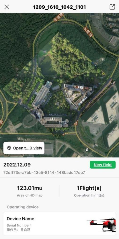
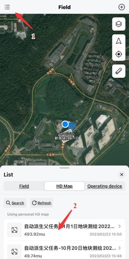
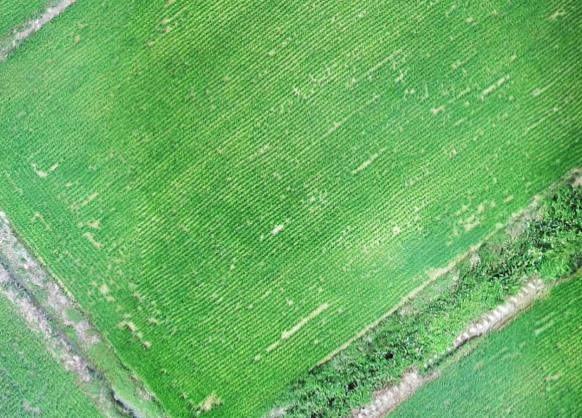
HD map in XAG ONE
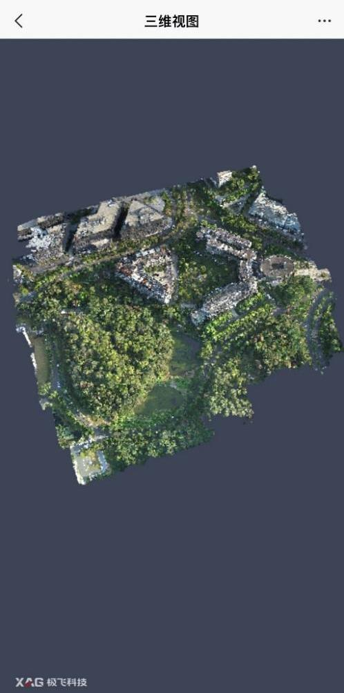
3D point cloud map in XAG ONE
Hardware Parameters
Variants
| Real Terra 1 | Real Terra 2 | |
| Photo |  |
 |
|
Mountable drones |
P40, V40 |
P100, V50 |
|
CMOS |
1/2.3 |
1/2.3 |
|
Pixel |
1200 |
1200 |
|
Image format |
JPG |
JPEG |
|
Lens Information |
FOV 112° 2.7mm/16.8mm |
FOV 112° 2.7mm/16.8mm |
Tips: There are two types of Real Terra 2 for P100 and V50 respectively. Their functions and parameters are the same, but they have a different structure to suit different drones.
Real Terra will generate a high resolution map that allows user to draw field boundaries.
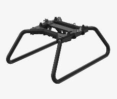
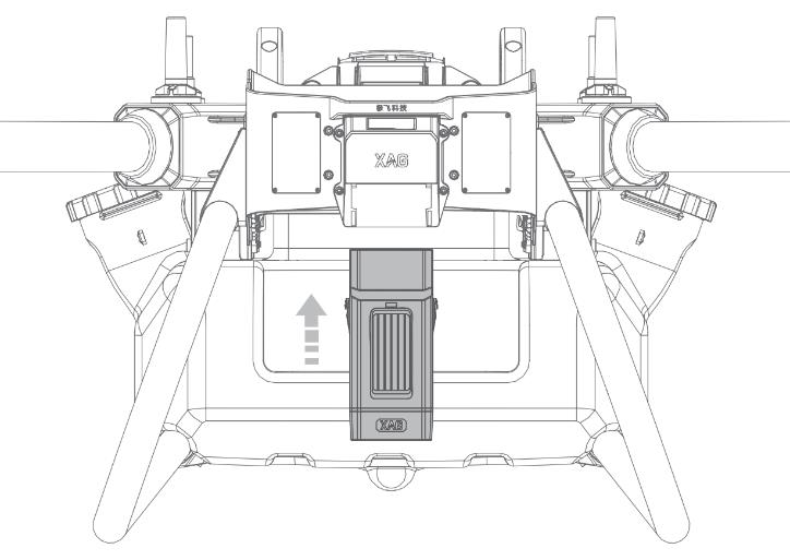
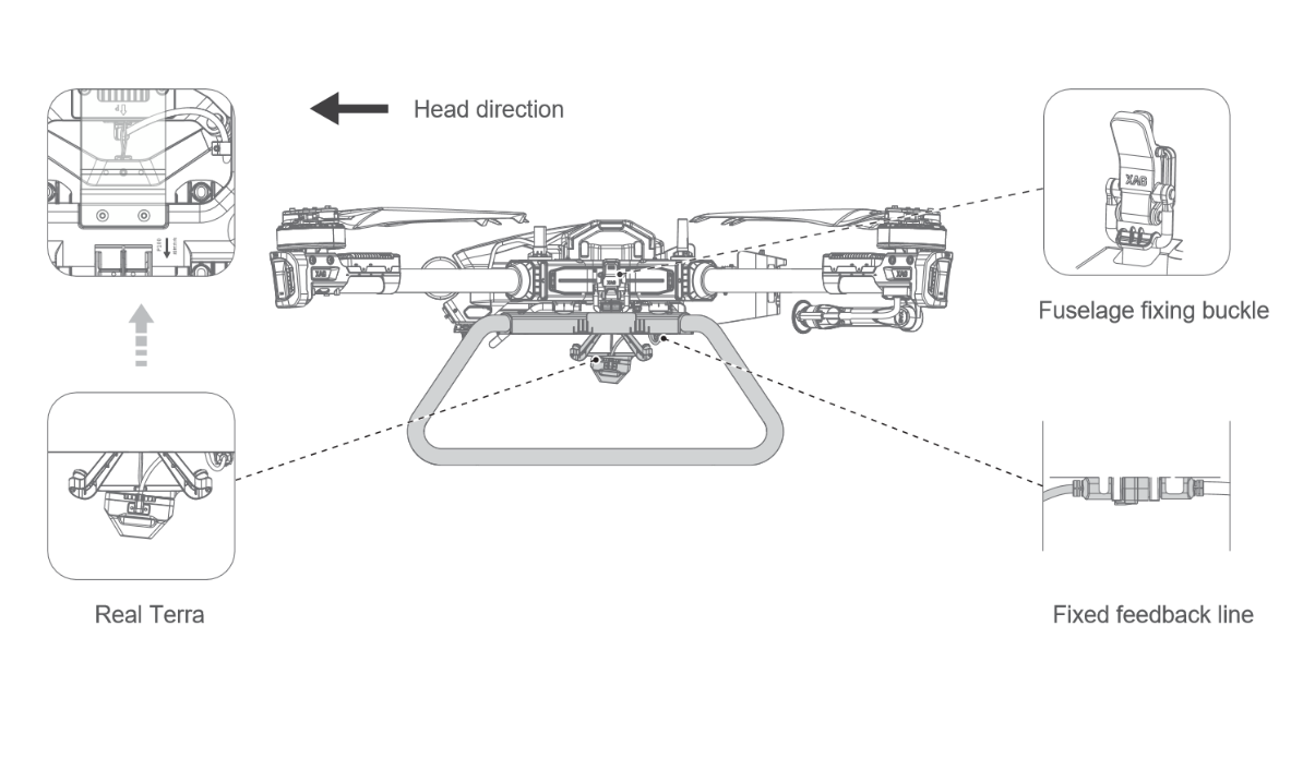
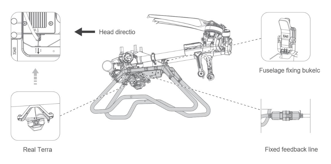
Structure
P100 Real Terra 2 Structure
V50 Real Terra 2 Structure
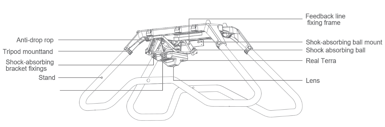
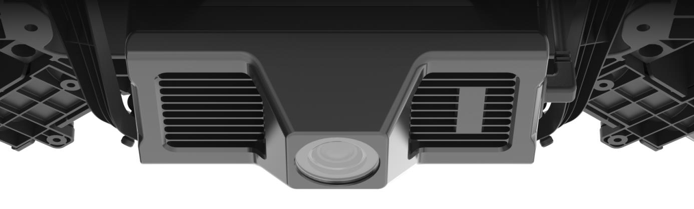
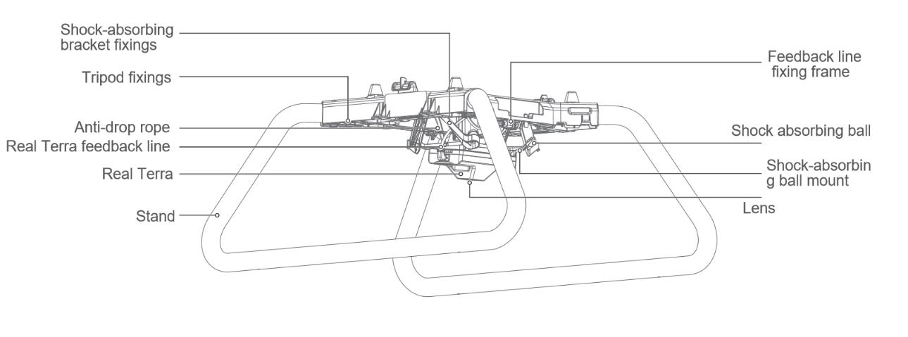
Schematic
Schematic of Real Terra 1
Schematic of Real Terra 2(P100)
Schematic of Real Terra 2(V50)
Map Transfer
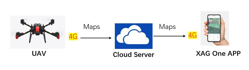
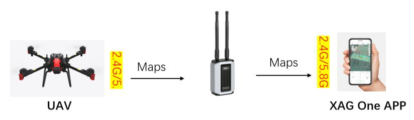
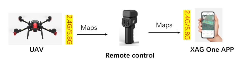
For Real Terra, there are three ways to transfer HD maps, 4G, LNT and RCN, same as the three operating modes of the drone. In 4G mode, the maps generated by Real Terra is uploaded to the cloud through the 4G network. XAG ONE APP can download maps on the cloud server and use it by agriculture drone. In LNT and RCN mode, the maps can be exported to the LNT or remote controller, then transfer to the XAG ONE APP.
4G mode
LNT mode
RCN mode
Tips for using Real Terra
- The flying height of Real Terra is fixed to 30m, and not to be changed.
- The largest area to use Real Terra 1 is 6.7 hectare/ Real Terra 2 is 13.3 hectare.
- The Real Terra does not save the photo, it just generates the HD maps/ 3D point cloud maps. You must connect the UAV with the RTK and ensure it has good signal when you use the Real Terra.
HD Map Usage
How to use the HD map(4G MODE)
1、Follow the manual to install Real Terra to the V40/P40/V50/P100.
2、Start mapping by XAG ONE APP.
3、Wait for HD map to upload to cloud server.
How to use the HD map(LNT MODE)
1、Follow the manual to install Real Terra to the V40/P40/V50/P100.
2、Start mapping by XAG ONE APP.
3、Wait for HD map images to be transferred to the phone via LNT.
How to use the HD map(RCN MODE)
1、Follow the manual to install Real Terra to the V40/P40/V50/P100.
2、Start mapping by XAG ONE APP.
3、Wait for HD map to be transmitted from the drone to the remote control and then to the phone.
View high resolution images in XAG ONE